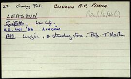
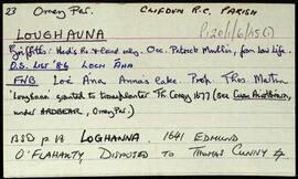
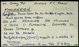
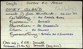
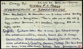
Index card for the townland of Gortacarnaun, [Gort an Charnáin].
Robinson,TimConnacht
558 Archival description results for Connacht
Set of index cards describing some of the natural physical features of the townland of Glionnán/Gleannán [Glennaun]. Anecdotal information from the Annála Beaga, and reference to Ferdinando Follin [Feargananim Folan], the landowner in 1641, later disposed to Sir Thomas Meredith. By the time of the sale of the Martin Estate in 1849, the land was used by tenants for putting cattle out to pasture. Features described include Tamhnach na gCoileach, Cnocán an Bhodaigh, Loch Fhada Ghlionnáin [Glennaun Lodge on the OS maps], and Aill Mhór Ghlionnáin. Some of the information Tim Robinson found for Glennán was in a letter by Eoin Ó'Néill. Seán Ó'Ceoinín is also a local source of information.
Robinson,Tim,Ó'Ceoinín,Seán,Ó'Néill,EoinSet of index cards describing some of the natural physical features of the townland of Glinsce [Glinsk]. Various sources are referenced giving insights into the origin of the placename, from Patrick Weston Joyce's 'The Origin and History of Irish Names of Places, Vol 3', which interprets it as the glen of the bramble bushes, to a local man who believes it derrives from 'gleann uisce'. Some notes are also provided on the modern day uses of buildings referenced in the OS maps, for instance the local school, Glinsk House, and Marble Studio. The physical features described are Loch an Roisín, Rusheen Point, Cnoc Glinsce, An Charraig Leith, Caladh Beag, An Caladh Mór, Corrán, a Children's Burial Ground, Loch Bhairtle, Barr an Linnín, Cnoc Bharr an Linnín, Abhainn Bharr an Linnín, Loch Cnocán na gCalapp, Caladh Thiobóid, Loch na Dubhaí (Lough Peastia on the OS maps, from the Irish word for worm, péist), Loichín Bharr an Chriathrach, Barr an Chlaí, Loch an Chaoráin, Céibh an Chaltha Mháire, Loch an Tamhnaigh, Tamhnachaí, Loch na Liathróide, Tulach na mBan, Loch an Mheill Mhóir, Tobar Mhuire, and Cuan na Beirtrí Buí. Information sourced from Bedford's map, Annála Beaga, and locally from Seán Ó'Ceoinín, Josie McDonncha, Frank Keaney and his grandmother, Josie Phádraig Cionnaigh, and Tomás Ó'Conghaile.
Robinson,Tim,Ó'Ceoinín,Seán,McDonncha,Josie,Keaney,Frank,Cionnaigh,Josie Phádraig,Ó'Conghaile,TomásSet of index cards describing some of the local features of Glinn Chatha, [Glencoh]. Included are descriptions of Loch an Aonoileáin, Tobar Chuimín, Aill na Staileach, Stáisiún Gainte Scríb Rosmuc (a turf-burning electricity generating station opened in 1957), Cora an Ghréa saí, Barr an Bhaile, Cora Chamais, Oileán na nGeabhróg, Oileán na nEach, and Carraig an Bhrandy. Tríosa Bean Uí Chonaire is credited as being a local source of information.
Robinson,Tim,Uí Chonaire,Tríosa BeanSome notes on the townland of Glennagevlagh [Gleann na nGeimhleach]. Summary references to various sources which outline the proprieter of the townland over the course of the last two centuries. A note on Tóin an Mhása, Binn Gharbh, St. Joseph's Well, and Log an Fhia. Bina McLochlainn is credited with providing some of the local information.
Robinson,Tim,McLochlainn,BinaSet of index cards describing the local features of the townland of Gleninagh [Gleann Eidhneach]. Features described are Binn an Eas, Gob na Gaoithe (Gubnagecha on Ordnance Survey), Mám Eidhneach, Binn Charrach, Scailp na gColm, Carrot Ridge, Benbaun, Binn an Choire Bhig, and Binn Charrach. Some small names from the field name books are also included. Local sources of information are credited as being William O'Brien of Loftaí, an old Irish speaking man in Leitheanach, and the local Bodkin lads.
Robinson,Tim,O'Brien,WilliamIndex card describing some of the local features of the townland of Gleninagh, [Gleann Eidhneach]. See also Roundstone Parish for descriptions of local feautres. One card is included here, giving references to more information about the townland.
Robinson,TimIndex card relating to the townland of Glengowla and Glengowla West, [Gleann Gabhla Thiar].
Robinson,TimSet of index cards describing the local features of the townland of Glencoaghan [Gleann Chóchan]. Features described include a lime kiln, Mám na bhFonsaí (recorded as Mám na Uinsí or rim in some places), Lotaí, Tinteánaí, Trinsí, Binn Dubh (Bencollaghduff on the OS map), The Planted Island, a Children's Burial Ground (a photo of which is included in 'Croí Chonamara'), Bengower, An Sindile (an arable area rich in quartz, and with a lime kiln), Mám Dearg (between Binn Dubh and Binn Bhán), Aill an Torainn, the mines (possibly sulphur), Binn Gabhair, Cnoc Trasna, Loch Cúl an Drama, Log an tSabha, Mám na Gaoithe, Mám an Lotaigh, and Fonsaí Ghaineamh. Local sources credited with providing information include local man Pat Joyce, Dela McAuley and Martin O'Malley, William O'Brien of Lotaí, Mrs Leonard of Ballinahinch Lodge, and John Hynes of Gleann Chóchan. (See also Teivebreen/Taobh Braoin for a brief description of Binn Briain, located between the two townlands).
Robinson,Tim,Joyce,Pat,McAuley,Dela,O'Malley,Martin,O'Brien,William,Hynes,John