UGA P/P120/1/6/8/1
·
Item
Part of Personal
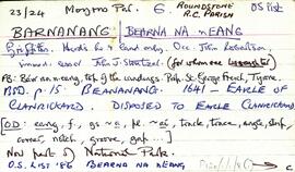
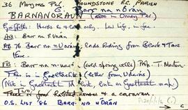
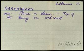
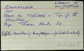
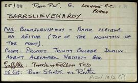
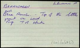
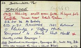
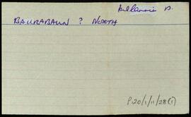
Set of index cards describing some of the local features of the townland of Barnahallia, [Bearna Aille]. A note summarising information from Griffith's Valuation, the OS map, the Field Name Book, and the Martin Estate Sale of 1849.
Robinson,Tim