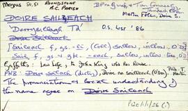
Set of index cards describing some of the local features of Doire Saileach [Derrysillagh]. Cora Bheag, Cora Raithní, Cor na nOchur, and Cor na Craoibhe are the local geographical features that are described. Tom Conneely, Martin Folan, and Bailte Fearainn na Gaeltachta are credited as being sources of information.
UntitledIreland
667 Archival description results for Ireland
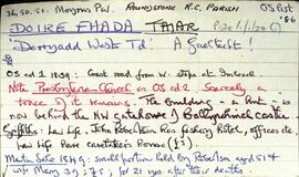
Set of index cards describing some of the local features of Doire Fhada Thiar [Derryadd West], a Gaeltacht area. Included in the descriptions are a note about the ruins of a Presbyterian Church, The Angler's Return (includes some notes on the Robertson family), Cor na mBriathare, Aill na gCúil, the fishery, the dyke, Botha Guaire, Sruthán Dearg, Céibhín Ghleann Aighneach, Lochán an Chaoile, Caorán an Iolra, Cloonisle Quay, Loch an Doirín, Aill an Eibhinn, Abhainn Mhór, The Fishery Hill, Caorán na Scraithe, and Imlach. Locals Pat and Annie Conneely, and Joe Nee credited with providing some of the information.
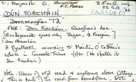
UntitledSet of index cards describing some of the local features of Dún Riacháin [Doonreaghan], a Gaeltacht area. The features described include Cora Hara, Doon House (originally the home of the Hazell family), Aill an Eibhinn, the Cashel Training Centre, Log an Iarainn, Caladh Mharcuis, and Fox Island. Tom Conneely was a local source who provided some of the information relating to this townland. Tom McDonagh of Tamhnach Bán told a story of a fox and a limpet in connection with the naming of Fox Island.
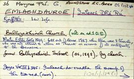
UntitledSet of index cards describing some of the local features of Emlaghdauroe [Imleach Dhá Rú]. Some notes on the translation of the placename as the swamp of the two red cows. Descriptions of the Roman Catholic chapel (formerly a Protestant Church), Binn Gleann Uisce, Emlaghmore, Loch an Easáin, Emlaghmore Lake, Knocknacalliagh Lough, Cross, and Conga Lough. Local sources of information are Martin King of Bar na Varán, Martin Halloran, John Joyce, and Paddy Linnane of Roundstone.
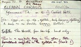
UntitledAn index card describing the townland of Gleann Chraois [Glencrees]. Features descried on a card include a quaking bog, horneblende crystals have been found near Cashel Hill, and a couple of sheep shelters.
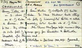
UntitledSet of index cards describing the local features of the townland of Garroman [An Gharmain]. The first card relays accounts from different histories of Galway about the residents of Garroman from the mid-nineteenth century. An account of a monastery in Garroman exists. Local features described include Glendollagh House, of which hardly a trace exists in the present day. A detailed history of its ownership is given on these cards. Gleann dá Loch, Loch an Aifrinn, Loch na mBreac Mór, Loch an Ghiolcaigh, Fairy Hill, Loch na Sáinne, Glendollagh Fishery, Lady Dudley's Nurse's Cottage, Imleach Bharr an tSrutháin, Imleach Láir, Imleach na Seamar, Garroman Lodge, the police barracks, lochán na meacan, loch uí mhainnín, loch an imligh eise, and Garroman lake are included in the descriptions. Local sources of information are local man Tom Joyce, Annie Joyce of Leitir Seanadh, Kevin Joyce, Martin O'Malley of Ballinafad, and Joe Mannion of Garroman.
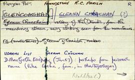
UntitledSet of index cards describing the local features of the townland of Glencoaghan [Gleann Chóchan]. Features described include a lime kiln, Mám na bhFonsaí (recorded as Mám na Uinsí or rim in some places), Lotaí, Tinteánaí, Trinsí, Binn Dubh (Bencollaghduff on the OS map), The Planted Island, a Children's Burial Ground (a photo of which is included in 'Croí Chonamara'), Bengower, An Sindile (an arable area rich in quartz, and with a lime kiln), Mám Dearg (between Binn Dubh and Binn Bhán), Aill an Torainn, the mines (possibly sulphur), Binn Gabhair, Cnoc Trasna, Loch Cúl an Drama, Log an tSabha, Mám na Gaoithe, Mám an Lotaigh, and Fonsaí Ghaineamh. Local sources credited with providing information include local man Pat Joyce, Dela McAuley and Martin O'Malley, William O'Brien of Lotaí, Mrs Leonard of Ballinahinch Lodge, and John Hynes of Gleann Chóchan. (See also Teivebreen/Taobh Braoin for a brief description of Binn Briain, located between the two townlands).
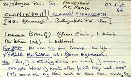
UntitledSet of index cards describing the local features of the townland of Gleninagh [Gleann Eidhneach]. Features described are Binn an Eas, Gob na Gaoithe (Gubnagecha on Ordnance Survey), Mám Eidhneach, Binn Charrach, Scailp na gColm, Carrot Ridge, Benbaun, Binn an Choire Bhig, and Binn Charrach. Some small names from the field name books are also included. Local sources of information are credited as being William O'Brien of Loftaí, an old Irish speaking man in Leitheanach, and the local Bodkin lads.
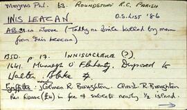
UntitledSet of index cards describing the local features of the townland of Inis Leacan [Inishlackan]. The ownership of the island is outlined from the 17th century, tracing its custodianship from the O'Flaherty clan, to the Blakes, the Broughton family from 1835, and Robert Macready of Ballinafad who bought it in 1900. Other sources of information consulted during this are listed as the 1st Report of the Fishery Commissioners, which came out in 1836, and Alex and John's log books, as well as a book entitled 'Three Men on an Island'. Some information on the Broughton family sourced in Griffith's Valuation is the subject of a couple of index cards. The features of Inis Leacan described here include Bodkin's House, some information about an account given by D'arcy Wentworth Thompson of a stay in Roundstone. Inis Leacan's school is also described, which closed in 1925 when the numbers fell below 25 pupils. The Mountain View Lodge, former home of the Broughton family, now a ruin is also described. Other physical features of the area that are described, are the Caorán, Duirling Mhór, The North Side of the island (as distinct from Trá Valley), Trá Valley (sometimes referred to as Trá an Bhaile), Carraig an Ghabhair, Fuaigh na Móna, Garraí Láir, Garraí Mór, Cnocán Mór, the Lighthouse Garden, Cnocán an tSagairt, Maoileann Garbh, Poll na Bantraí, Poll Bhairtleimíd, Poirín Beag, Poll na Cloiche, Trá na Feamainne, Cor na Cloiche, Raic Bay, Tóin an Oileáin, Trá Bheag, Aill na Brón, Poll na Stiúrach, Trá Roilligh, Barr na Leapa, Searrach Beag, Searrach Mór, Inis Leacan harbour, Poll Bréan, Inis Leacan beach, Cnocán an Ghréasaí, Cora Lín, Fuaigh Chaol, Carraig an Duilisc, Table Rock, Duirling na Glafaí, Carraig Íochtair, Céibh Mhaitiú, Carraig Báid Bán, Cloch Bhuí, Sceird, Lochán na mBallach, Garraí na Scraithe, Carraig na Ceilpe, Carraig an Iasc, Carraig na Leabhaí, Carraig na bPortán, Leachta Buí, Aill an Chipín, Carraig na gCon, Carraig na Beirtrí, and St. MacDara's well. Paddy McDonagh is a local source credited with providing information.
UntitledDescription of Cnoc na hUillinne, (a hill of the same name in An Uillinn Thoir), a prominent physical feature of An Uillinn Thiar [Illion West].
Untitled