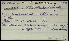
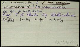
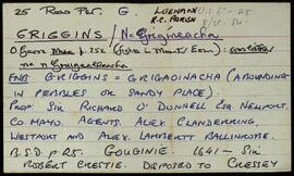
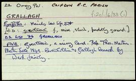
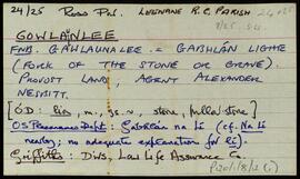
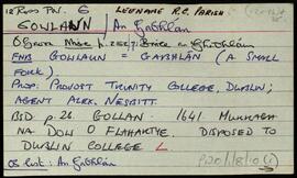
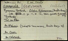
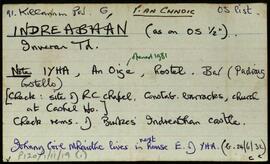
Set of index cards describing some of the local features of the townland of Indreabhán [Inveran]. Several cards on the Blake family (at the time of Griffith's Valuation, Patrick Blake was the Lessor, a note on Cashel House where the Blake family lived, and brief notes on Loch a' Mháire, Ballaí Indreabháin, Cnocán an Bhacaigh, Trá an Tulaigh, the Roman Catholic Church, Na Creigeáin, and a note on the Protestant Ministers. Seán Ó'Máinnín is credited as being a local source of information.
Robinson,Tim,Ó'Máinnín,SeánIreland
667 Archival description results for Ireland
Set of index cards describing some of the local features of Illeny, [Na hUillinní]. Cora Chonaill, Sruthán Buí, Loch na nUilleann, and An Doirín (a patch of pastorage around the only inhabited house in the townland), are briefly described in this set of cards. Séan Neide Ó'Conghaile of Gleann Trasna, and Paddy Foren of Scríb are credited as being local sources of information.
Robinson,Tim,Ó'Conghaile,Séan Neide,Foren,PaddySet of index cards giving a description of the townland of High Island, [Ardoileán]. Included are a note on Richard Murphy, the poet, who bought High Island in the 1960's, and a general note on the terrain of the island itself. Also included are descriptions of The Chisters (two islets called Carrickarone on the OS maps), Dublin (a passage between cliffs), Fuagh na Cara, Fuagh an Mhianaigh, Promontory Fort, and the Copper Mine. A fisherman on the island provided some of the local information.
Robinson,TimSet of index cards describing some of the local features of Halfcartron, [An Leathchartúr ]. Included are descriptions of Coill Beag (an enclosed hill to the South East of Tullaghnakernishna Hill), and Loch Coill Bheag. A stream in the centre of the townland that Robinson calls Sruthán Mór is also described. Peter Joyce of Úráid is credited as being a local source of information.
Robinson,Tim,Joyce,PeterA set of index cards outlining some of the local features of the townland of Griggins, [Na Grigíneacha]. Included are descriptions of Binn Uí Choinneáin, Joyce's River, a note on the Dún marking the site of one of the ancient churches of the area, Bothar na sean-shráinsighe, a note on Maam Country Knitwear run by Ann and Dennis Kindrick, , and An t-Easáin. Mrs. Mary Keane of Maum East, and Michael Kyne of Maam West are credited with providing some of the local information.
Robinson,Tim,Keane,Mary,Kyne,MichaelA set of index cards outlining some of the local features of the townland of Gowlaunlee, [Gabhlán na Lí]. Some summary notes from O'Donovan's name books, Griffith's Valuation, and the Placenames Department of the OS. Also included are summary descriptions of Birallate rath, Binn, Mám a Tuirc Móir, Gabhlain Ard, a note on the King Cottages (and Mr. King who was involved in the 1921 Munterowen ambush between the IRA and RIC), a note on Cillín (a children's burial ground), Anacair, Taobh Bán, Mám Ochóige, Mám Tuirc, and a detailed note on Pádraig Ó'Máille's cave (and a detailed sketch). The cave dates back to Spring 1918, and was used as a hideout by IRA leaders in the ensuing years.
Robinson,Tim