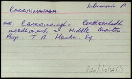
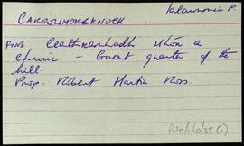
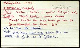
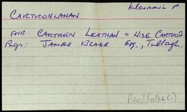
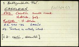
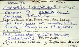
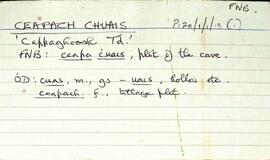
Set of index cards describing some of the features of the townland of Carna. Description of Annála Beaga, a pub built by a priest, which later sold fishing gear. Included in the descriptions are the RIC Barracks (a fellow of the ruined barracks in Caherciveen), Cúbh an Chrompáin, Poll an Athar Peadar, Teach Phobail Naomh Maire, Idir Dhá Locha, An Sruthán Dearg, Ruaoileán, An Chréibhín, Cora Bharr na hAbhann, Loch na Lannach, Abhainn Bheag, Abhainn na Seainimhe, Loch na Calgaí, Lathach na bhFód, Na Dolachta Móra agus Beaga, Oileán an Fhiaich, Oileán na Scuaibe, Na Searaí, Baile an tSléibhe, An Tulach, Abhainn Charna, Caorán Chárna, Roisín na Tamhnaí, Dothulach, Cluais Ghiorria, and Loch Céim na Caillí. Seán Ó'Ceoinín, a Bourke of An Troscán, J Guairim, Roisín Ní Mainiach, and John Mercer credited with providing some of the information.
Robinson,Tim,Ó'Ceoinín,S.,Guairim,J.,Ní Maithniach,Roisín,Mercer,John