Ireland
667 Archival description results for Ireland
667 results directly related
Exclude narrower terms
UGA P/P120/1/3/53/1
·
Item
Part of Personal
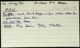
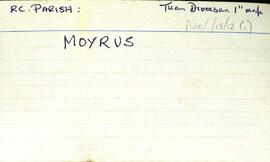
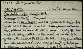
Set of index cards describing some of the local features of Moyard, [Maigh Ard]. Included are descriptions of Ballynakill Church (Church of Ireland, the description includes a list of the Rectors from 1852), the Parochial School, and Tobardavin with grave.
Robinson,Tim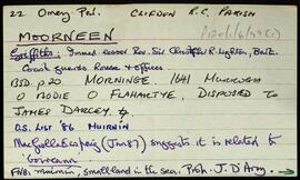
UGA P/P120/1/6/47/1
·
Item
Part of Personal
Set of index cards giving a brief description of the townland of Moorneen [Muirnín]. Included are descriptions of a megalith (a two chambered tomb, and a small accompanying sketch), the children's burial ground, the former coastguard station, and a note on Sellerna Bay.
Robinson,Tim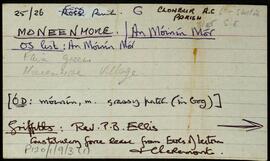
UGA P/P120/1/9/3/1
·
Item
Part of Personal
Set of index cards detailing some of the local features of the townland of Moneenmore [An Móinín Mór]. Included are a note on the history of the Maam Hotel, Keane's Bar (the former site of the hotel), Meall an Mhaide, Binn Dubh, Court House, the former Fair Green, the former Post Office (where Willy Crawford lives now), and Maam Bridge.
Robinson,Tim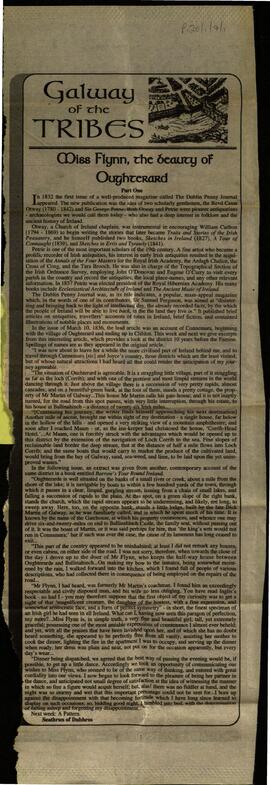
UGA P/P120/1/7/1/1
·
Item
Part of Personal
A cutting of a piece from the Galway Advertiser by Seathrun of Dubhros, entiteld "Miss Flynn, the beauty of Oughterard".
Dubhros,Seathrun of,Galway Advertiser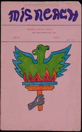
UGA P/P163/1/1/1
·
Item
·
2024-09-11
Part of Personal
Issue number 8 of 'Mísneach', produced by 'Sentenced Republican Prisoners, Long Kesh Concentration Camp', Maze Prison, Cage 18, February 1974.
Paddy McMenamin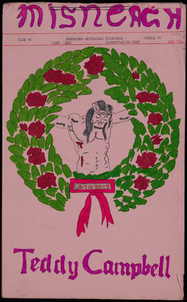
UGA P/P163/1/2/1
·
Item
·
2024-09-11
Part of Personal
Issue number 10 of 'Mísneach', produced by 'Sentenced Republican Prisoners, Long Kesh Concentration Camp', Maze Prison, Cage 18, May 1974.
Paddy McMenamin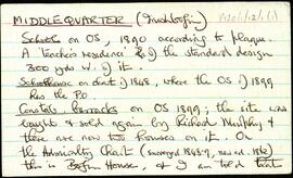
UGA P/P120/1/12/1/1
·
Item
Part of Personal
Series of notes about the local features of Middlequarter, [An Cheatrú Láir], a townland located on Inishbofin. The following are features that are given some attention. The local school, founded in 1890, the old Constabulary Barracks (Bofin House), St. Colman's Church (the Roman Catholic chapel), Patches, a note on Bofin House and the Allies family, Áit Tí Ghuairim, Cat's Hole, The High Road, The Low Road, Guairim's Castle, The Pound Road, The Saltbox, Dooneen, Claisaigh, Tarrachan, Lough Fawna, The Mill, and Dead Man's Cove. Paddy Murray, Mrs. Burke, and several secondary sources are credited as being valuable sources of information for this townland.
Robinson,Tim,Murray,Paddy
UGA P/P120/1/9/4/1
·
Item
Part of Personal
A set of index cards detailing some of the local features within the Civil Parish of Ross (some of these are in Co. Mayo). Included are a note on the Anglican Episcopalian Church of St. John the Baptist, and its rector Robert McKeown. A detailed note is included of Magairlí an Deamhain (the peak Devilsmother). Aasleagh Falls (the site of the murder in the film 'The Field), Gleann na nÉan, Inishdegil. A note on the Baptismal Font in Aasleagh, dedicated to the beloved and esteemed memory of the Honorary David Plunkett who died in 1868, and a list of the memorials inside the Church at Aasleagh. Also a note on Eas Rua, Maumetrasna, Erriff River, and Aasleagh Lodge.
Robinson,Tim