Connemara
559 Archival description results for Connemara
559 results directly related
Exclude narrower terms
UGA P/P120/1/11/53/1
·
Item
Part of Personal
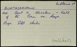
Index card for the townland of Gortacarnaun, [Gort an Charnáin].
Untitled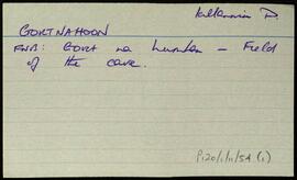
UGA P/P120/1/11/54/1
·
Item
Part of Personal
Index card for the townland of Gortnahoon, [Gort na hUamhan].
Untitled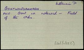
UGA P/P120/1/11/55/1
·
Item
Part of Personal
Index card for the townland of Gortnandarragh/Oakfield, [Gort na nDarach].
Untitled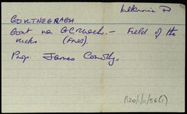
UGA P/P120/1/11/56/1
·
Item
Part of Personal
Index card for the townland of Gortnegragh/Gortnagroach [Gort na gCruach].
Untitled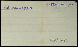
UGA P/P120/1/11/57/1
·
Item
Part of Personal
Index card for the townland of Keeraunagark, [no record on logaim].
Untitled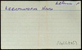
UGA P/P120/1/11/58/1
·
Item
Part of Personal
Index card for the townland of Keeraunnagark North, [Caorán na gCearc Thuaidh].
Untitled
UGA P/P120/1/11/59/1
·
Item
Part of Personal
Index card for the townland of Killaguile, [Cill an Ghaill].
Untitled