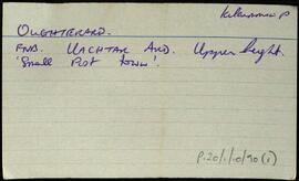
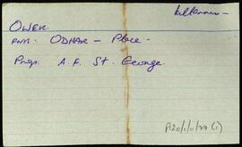
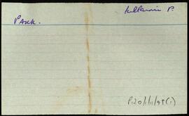
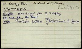
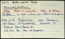
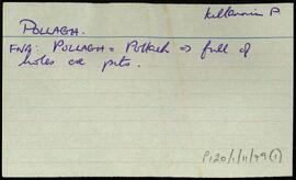
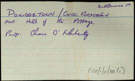
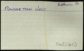
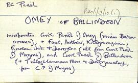
Overview list of the following townlands within the Roman Catholic Parish of Omey or Ballindoon. This incorporates the Civil Parish of Omey, minus Barnanoraun, and the Civil Parish of Ballindoon, (plus Tullaghlumman More and Derrycunagh). The cards include the Irish and English language renditions of the townland names.Ardbear [Ard Béara], Derrycunlagh [Coire Chunlaigh], Derrylea [Doire Liath], Faul [Na Fáil], Gowlaun West [Gabhlán], Killymongaun [Cill Uí Mhongáin], and Tullaghlumman More [Tulach Lomáin Mhór].
Robinson,TimConnemara
559 Archival description results for Connemara
Index card relating to the townland of Oughterard, [Uachtar Ard]. A note on Tulaigh an Coraigh, the Hill of the Fair.
Robinson,TimSet of index cards describing some of the local features of the townland of Pollacappul, [Poll an Chapaill]. Included are descriptions of Kylemore Castle/Abbey, Beannaí Mhóra, Lough Tauther, Duchrua, Kylemore Gardens, Culóg, and Kylemore Church and Mausoleum. Also included are a short biography of Mitchell Henry, a consulting surgeon in Middlesex Hospital, who represented Galway as an MP in the late nineteenth century. Also a short outline of relevant members of the Wilbeforce family. A Mr. Mangan of Currywongan is credited with providing some of the local information.
Robinson,TimSet of index cards describing some of the local features of the townland of Pollrevagh, [An Poll Riabhach]. Included are descriptions of Inis Caorach, Scoth Point (the westernmost point), Pollrevagh Bay, and Cara Beag. Local man John Abbie Conneelly, and John O'Malley of Ballyconneelly are credited with providing some of the local information.
Robinson,Tim,King,SeánIndex card for the townland of Poridgetown (East), [Cnoc an Bhracháin Thoir].
Robinson,TimIndex card for the townland of Poridgetown (West), [Cnoc an Bhracháin Thiar].
Robinson,Tim