Connemara

Elements area

Taxonomy

Code

Scope note(s)

    Source note(s)

      Display note(s)

        Hierarchical terms

        Connemara

          Equivalent terms

          Connemara

            Associated terms

            Connemara

              559 Archival description results for Connemara

              559 results directly related Exclude narrower terms
              Gorteennaglogh
              UGA P/P120/1/3/34/1 · Item
              Part of Personal

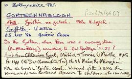
              Set of index cards describing some of the local features of the townland of Gorteennaglogh, [Goirtín na gCloch]. Included are the story behind the song 'Amhráin Chlainne Gael', and descriptions of St. Patrick's National School, Tully Cross Chapel, , Gorteennaglogh enclosure, Gorteen Bay and Quay, Tully Cross, Ceartaí, and The Rape Hill, which is thought to refer to a rape field that was there in the time of the Blakes.

              Robinson,Tim
              Gortdrishagh
              UGA P/P120/1/10/71/1 · Item
              Part of Personal

              Set of index cards relating to the townland of Gortdrishagh, [An Gort Driseach].

              Robinson,Tim
              Gortacarnaun
              UGA P/P120/1/11/53/1 · Item
              Part of Personal

              Index card for the townland of Gortacarnaun, [Gort an Charnáin].

              Robinson,Tim
              Glionnán / Gleannán
              UGA P/P120/1/2/24/1 · Item
              Part of Personal

              Set of index cards describing some of the natural physical features of the townland of Glionnán/Gleannán [Glennaun]. Anecdotal information from the Annála Beaga, and reference to Ferdinando Follin [Feargananim Folan], the landowner in 1641, later disposed to Sir Thomas Meredith. By the time of the sale of the Martin Estate in 1849, the land was used by tenants for putting cattle out to pasture. Features described include Tamhnach na gCoileach, Cnocán an Bhodaigh, Loch Fhada Ghlionnáin [Glennaun Lodge on the OS maps], and Aill Mhór Ghlionnáin. Some of the information Tim Robinson found for Glennán was in a letter by Eoin Ó'Néill. Seán Ó'Ceoinín is also a local source of information.

              Robinson,Tim,Ó'Ceoinín,Seán,Ó'Néill,Eoin
              Glinsce
              UGA P/P120/1/2/23/1 · Item
              Part of Personal

              Set of index cards describing some of the natural physical features of the townland of Glinsce [Glinsk]. Various sources are referenced giving insights into the origin of the placename, from Patrick Weston Joyce's 'The Origin and History of Irish Names of Places, Vol 3', which interprets it as the glen of the bramble bushes, to a local man who believes it derrives from 'gleann uisce'. Some notes are also provided on the modern day uses of buildings referenced in the OS maps, for instance the local school, Glinsk House, and Marble Studio. The physical features described are Loch an Roisín, Rusheen Point, Cnoc Glinsce, An Charraig Leith, Caladh Beag, An Caladh Mór, Corrán, a Children's Burial Ground, Loch Bhairtle, Barr an Linnín, Cnoc Bharr an Linnín, Abhainn Bharr an Linnín, Loch Cnocán na gCalapp, Caladh Thiobóid, Loch na Dubhaí (Lough Peastia on the OS maps, from the Irish word for worm, péist), Loichín Bharr an Chriathrach, Barr an Chlaí, Loch an Chaoráin, Céibh an Chaltha Mháire, Loch an Tamhnaigh, Tamhnachaí, Loch na Liathróide, Tulach na mBan, Loch an Mheill Mhóir, Tobar Mhuire, and Cuan na Beirtrí Buí. Information sourced from Bedford's map, Annála Beaga, and locally from Seán Ó'Ceoinín, Josie McDonncha, Frank Keaney and his grandmother, Josie Phádraig Cionnaigh, and Tomás Ó'Conghaile.

              Robinson,Tim,Ó'Ceoinín,Seán,McDonncha,Josie,Keaney,Frank,Cionnaigh,Josie Phádraig,Ó'Conghaile,Tomás
              Glinn Chatha
              UGA P/P120/1/7/18/1 · Item
              Part of Personal

              Set of index cards describing some of the local features of Glinn Chatha, [Glencoh]. Included are descriptions of Loch an Aonoileáin, Tobar Chuimín, Aill na Staileach, Stáisiún Gainte Scríb Rosmuc (a turf-burning electricity generating station opened in 1957), Cora an Ghréa saí, Barr an Bhaile, Cora Chamais, Oileán na nGeabhróg, Oileán na nEach, and Carraig an Bhrandy. Tríosa Bean Uí Chonaire is credited as being a local source of information.

              Robinson,Tim,Uí Chonaire,Tríosa Bean
              Glennaun
              UGA P/P120/1/11/52/1 · Item
              Part of Personal

              Index card for the townland of Glennaun, [Gleannán].

              Robinson,Tim
              Glennagevlagh
              UGA P/P120/1/8/11/1 · Item
              Part of Personal

              Some notes on the townland of Glennagevlagh [Gleann na nGeimhleach]. Summary references to various sources which outline the proprieter of the townland over the course of the last two centuries. A note on Tóin an Mhása, Binn Gharbh, St. Joseph's Well, and Log an Fhia. Bina McLochlainn is credited with providing some of the local information.

              Robinson,Tim,McLochlainn,Bina
              Gleninagh
              UGA P/P120/1/1/33/1 · Item
              Part of Personal

              Set of index cards describing the local features of the townland of Gleninagh [Gleann Eidhneach]. Features described are Binn an Eas, Gob na Gaoithe (Gubnagecha on Ordnance Survey), Mám Eidhneach, Binn Charrach, Scailp na gColm, Carrot Ridge, Benbaun, Binn an Choire Bhig, and Binn Charrach. Some small names from the field name books are also included. Local sources of information are credited as being William O'Brien of Loftaí, an old Irish speaking man in Leitheanach, and the local Bodkin lads.

              Robinson,Tim,O'Brien,William
              Gleninagh
              UGA P/P120/1/3/33/1 · Item
              Part of Personal

              Index card describing some of the local features of the townland of Gleninagh, [Gleann Eidhneach]. See also Roundstone Parish for descriptions of local feautres. One card is included here, giving references to more information about the townland.

              Robinson,Tim