Connemara

Elements area

Taxonomy

Code

Scope note(s)

    Source note(s)

      Display note(s)

        Hierarchical terms

        Connemara

          Equivalent terms

          Connemara

            Associated terms

            Connemara

              559 Archival description results for Connemara

              559 results directly related Exclude narrower terms
              Clifden Demesne
              UGA P/P120/1/6/12/1 · Item
              Part of Personal

              Set of index cards describing some of the local features of the townland of Clifden Demesne, [Diméin an Chlocháin]. Included are descriptions of Dumhach Beag Quay, Caster Grounds, Clifden Castle, a note on the D'arcy's, Eyre's Graveyard, The Cove (also known sometimes as the ladies beach), The Mine Road, Standing Stones, and a brief note on the Eyres.

              Robinson,Tim
              Cloch na Rón
              UGA P/P120/1/1/55/1 · Item
              Part of Personal

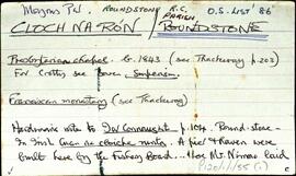
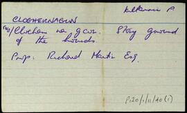
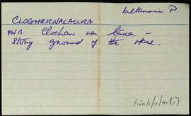
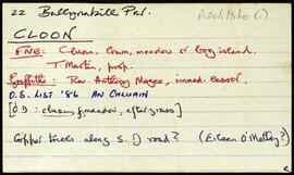
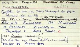
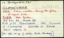
              Set of index cards describing some of the local ecclesiastical, historical, and geographical features of Roundstone, [Cloch na Rón]. Background information sourced from Hardiman, and from the 1849 sale of the Martin Estate which covers the building of a pier there by the Fisheries Board and Alexander Nimmo. Included in the descriptions are the 19th century Protestant Church and its memorials, the Presbyterian Meeting House which was demolished in 1930, the Presbyterian Church, the Franciscan Monastery, The Fort, (occupied for a while by Sting of 'The Police'), The Old Store, Garryowen, Srutháin na Srúille, the Harbour, Ballagh House, Roundstone Bay, Waymount, Clougherty's (a shop and pub, and the site of the current Garda station), Bólard, the Coastguard's Office (referred to as The Boat House in 1899 map), Farrell's Road (a site of several Famine graves), Ballagh House, Newton Buildings (now the site of the local Health Centre), The Old Quay, the Catholic Church which was built in 1830, and the knitting factory. Summary of some of the information from the Royal Commision of Inquiry into the State of Irish Fisheries, 1836, from the Roundstone Famine Relief Committee, and from the Martin Estate Sale document of 1849. One card giving an account entitled 'The Story of Alice', referring to Alice McCaulter. Noel King, Michael Verron, M. Bairéad, and John McQuaid are all credited with providing some of the information and anecdotes in these notes. The Galway Vindicator was also a source of information about the Roundstone Famine Relief Committee.

              Robinson,Tim,King,Noel,Verron,Michael,Bairéad,M.,McQuaid,John,The Galway Vindicator,Great Britain. Royal Commission of Inquiry into the State of Irish Fisheries,1836,Roundstone. Famine Relief Committee
              Cloghaunard
              UGA P/P120/1/6/14/1 · Item
              Part of Personal

              Two index cards describing some of the local features of the townland of Cloghaunard, [An Clochán Ard]. A brief note on Loch an Irne/Buttermilk Lake is included here.

              Robinson,Tim
              Cloghermore
              UGA P/P120/1/10/44/1 · Item
              Part of Personal

              Three index cards relating to the townland of Cloghermore, [An Clochar Mór].

              Robinson,Tim
              Cloghernagun
              UGA P/P120/1/11/40/1 · Item
              Part of Personal

              Index card for the townland of Cloghernagun [Clochar na gCon].

              Robinson,Tim
              Cloghernalaura
              UGA P/P120/1/11/41/1 · Item
              Part of Personal

              Index card for the townland of Cloghernalaura, [Clochar na Lára].

              Robinson,Tim
              UGA P/P120/1/11/42/1 · Item
              Part of Personal

              Index card for the townland of Cloghmore, [Cloch Mór]. Included are descriptions of Cuan na sgailte, and Tuaig an Tobair.

              Robinson,Tim
              Cloon
              UGA P/P120/1/3/10/1 · Item
              Part of Personal

              Set of index cards describing some of the local features of the townland of Cloon [An Chluain], including a copper mine, Lough Woongar (Loch Moin Gearr), Tuairín na Cloiche Finne, and an overgrown cave. Eileen O'Malley and Patrick Conroy are credited with providing some of the information.

              Robinson,Tim,O'Malley,Eileen,Conroy,Patrick
              Cloonbeg
              UGA P/P120/1/1/17/1 · Item
              Part of Personal

              Index card which summarises the returns from Griffith's Valuation, and gives information from the original 19th century ordnance survey map, and information from the corresponding Field Name Book, for Cloonbeg [Cluain Beag].

              Robinson,Tim
              Clooncree
              UGA P/P120/1/3/15/1 · Item
              Part of Personal

              Set of index cards describing some of the local features of the townland of Clooncree, [Cluain Crí]. St. Canannagh's well and a megalithic tomb are included in the description.

              Robinson,Tim