UGA P/P120/1/2/5/1
·
Item
Part of Personal
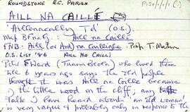
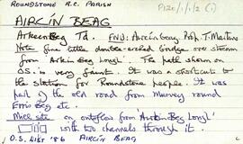
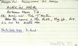
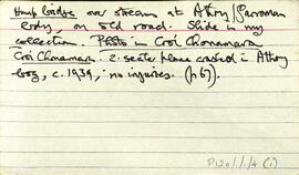
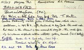
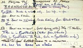
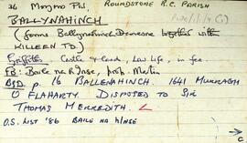
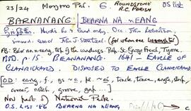
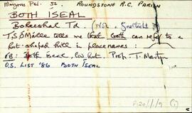
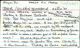
Set of index cards describing some of the features of Bior/Oileán Biorach. There are two islands Bior Beag and Bior Mór [Birbeg and Birmore]. Including in the descriptions are Carraig Shiobhán Uí Bheara, Na Biolla/Na Briolla, Béal na gCleasach, Carraig a Marth, Leac Bhaile, Leac an Ruathair, Mall an Chaladh, Carraig na Maidhne, An Baláiste, Carraig na gCapaill, Bior Beag (uninhabited save for cattle), An tIfearnáin, and Tobar na nIfearnáin. P de Búrca, Roisín Ní Maithniach, and S Ó'Ceoinín are credited with providing information.
Untitled