Connacht
558 Archival description results for Connacht
558 results directly related
Exclude narrower terms
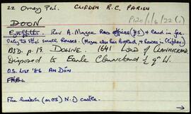
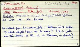
UGA P/P120/1/6/22/1
·
Item
Part of Personal
Set of index cards giving a description of the townland of Doon, [An Dún]. Included are descriptions of Doon House, which was demolished c. 1975. Also Caisleán an Dúna, and Tulach. Peter and Ann Molloy of Cushatrough are credited with providing some of the local information.
Robinson,Tim,Molloy,Peter,Ann
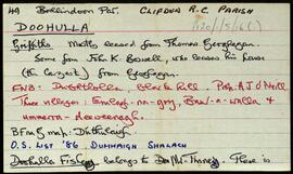
UGA P/P120/1/5/16/1
·
Item
Part of Personal
Set of index cards describing some of the local features of the townland of Doohulla, [Dumhaigh Shalach]. Included are descriptions of Caorán, The Maoilíns, Loch an Mheacain Mhóir, Loch Aill an Mhadra, Barrowen Lough, The Mill Road, Imleach Dhumhaigh Shalach, An Bóthar Díreach, Imleach an Graidhine, The Caochadán's River, Poll Dóibe, Loch na Móna, Loch Ceanncóige, Doohulla Fishery, Doohulla Lodge, and Ballyconneely Bay Oyster Beds. Brendan Joyce of Doohulla, J. Joyce of Ballyconneely, Michael Gould of Emlaghmore, a Conneely of Foorglass, Noel Wilkins' 'Ponds, Parks, and Passes', and Hayes manuscript sources are credited as being some of the sources of information.
Robinson,Tim,Joyce,Brendan,J.,Gould,Michael
UGA P/P120/1/5/14/1
·
Item
Part of Personal
Set of index cards describing some of the local features of the townland of Dolan, [An Dólainn]. Included are descriptions of Tuarán na gCaorach, Loch na nUan, Raithneachán, Crocán an Phríosúin, Acres, Sruthán na gCapall, Priest's Rock, Graveyard, Horn (so named because it was once the site of a fog horn), Trá Mhíl, Mullán Mór, Fearabháin Lake, Carraig an Lochán, Carraig an Phortáin, Trá Mhór, Droim, Loch na gCrann, Bóthar Torra, Trá Mhíl, Scanamh/Scanabh/Scaineamh Harbour, Blane/Bléib Mhór Harbour, and Smotán. John King of Roundstone, Noel Mannion of Murvey, Martin O'Malley of Roundstone, and an un-named elderly local resident are credited with providing some of the local information.
Robinson,Tim,King,John,Mannion,Noel,O'Malley,Martin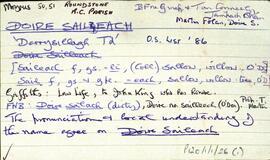
UGA P/P120/1/1/26/1
·
Item
Part of Personal
Set of index cards describing some of the local features of Doire Saileach [Derrysillagh]. Cora Bheag, Cora Raithní, Cor na nOchur, and Cor na Craoibhe are the local geographical features that are described. Tom Conneely, Martin Folan, and Bailte Fearainn na Gaeltachta are credited as being sources of information.
Robinson,Tim,Conneely,Tom,Folan,Martin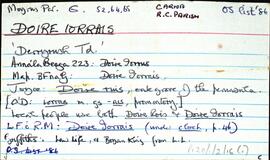
UGA P/P120/1/2/16/1
·
Item
Part of Personal
Set of index cards describing some of the features of the townland of Doire Iorrais [Derryrush]. Included in the descriptions are Loch an Bhaile, Reilg na bPáistí (more commonly known as An Chill Bheag), An Liocáin Mór and An Liocáin Beag, Bóthar na Cuinge, Bun Inbhir, Loch an Doirín (Lough Aderreen on the OS map), An Cíocrach, Éasc Glasóg, Droim Bharr na hAbhann, Céibh Liocáin, Loch Liocáin, Binn an Duine (a cliff face named after an 18 year old who fell there), and Loch Choirill (a now empty fishing lodge on the lake island). P MacDonncha and Pat Sullivan credited with providing some of the information.
Robinson,Tim,MacDonncha,P.,Sullivan,Pat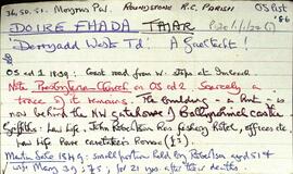
UGA P/P120/1/1/27/1
·
Item
Part of Personal
Set of index cards describing some of the local features of Doire Fhada Thiar [Derryadd West], a Gaeltacht area. Included in the descriptions are a note about the ruins of a Presbyterian Church, The Angler's Return (includes some notes on the Robertson family), Cor na mBriathare, Aill na gCúil, the fishery, the dyke, Botha Guaire, Sruthán Dearg, Céibhín Ghleann Aighneach, Lochán an Chaoile, Caorán an Iolra, Cloonisle Quay, Loch an Doirín, Aill an Eibhinn, Abhainn Mhór, The Fishery Hill, Caorán na Scraithe, and Imlach. Locals Pat and Annie Conneely, and Joe Nee credited with providing some of the information.
Robinson,Tim,Conneely,Annie,Pat,Nee,Joe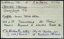
UGA P/P120/1/11/9/1
·
Item
Part of Personal
Set of index cards detailing some of the local features of the townland of Doire Choill, [Derrykyle]. Included are descriptions of Loch an Tairbh, and Caorán.
Robinson,Tim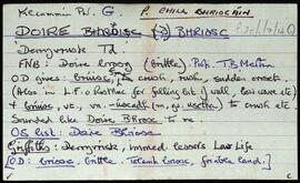
UGA P/P120/1/7/14/1
·
Item
Part of Personal
Set of index cards describing some of the local features of Doire Bhriosc, [Derryvrisk]. Included are descriptions of Caorán, Tobar Phádraic, Doirín, Loch Sheana na Siongán, and Droichidín na Circe Fraoigh. An un-named man in Leitir More na Coille, Paddy Folen of Scríb, and Peter Flaherty of Camas are credited as being local sources of information.
Robinson,Tim,Folan,Paddy,Flaherty,Peter