UGA P/P120/1/3/71/1
·
Item
Part of Personal
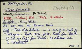
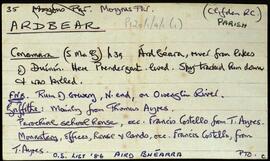
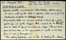
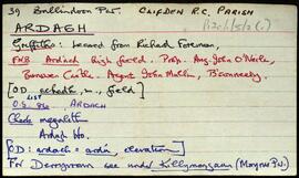
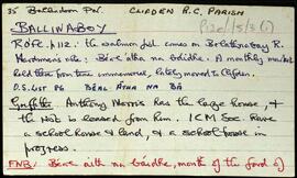
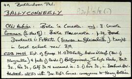
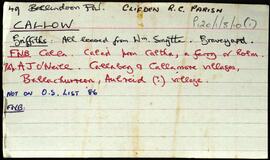
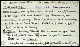
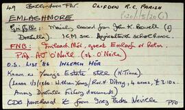
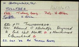
Set of index cards describing some of the local features of the townland of Tully Beg. [An Tulaigh Bheag]. Included are descriptions of Renvyle Church and graveyard (Church of Ireland), and a list of the graves there. Also a description of the White Strand, sometimes known as Tullybeg Beach.
Untitled