UGA P/P120/1/4/1/1
·
Item
Part of Personal
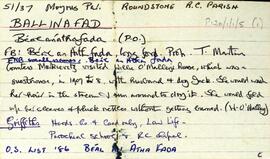
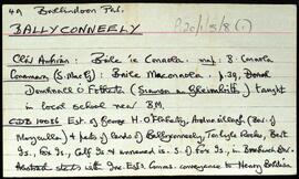
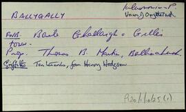
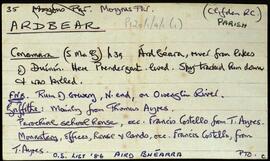
Set of index cards describing some of the local features of the townland of Ardbear, [Aird Bhéarra]. Included are descriptions of Owenglen Falls, (the site of Daniel O'Connell's meeting in 1843, and home to a lodge which featured in 'The Quiet Man'). Ardbear Lake, Cuan Airdbéara (where some members of the Coney family resided), Creighton's Hill, Ardbear Bay oyster beds, Tobberbeggan Holy Well, Ardbear Monastery, an Orphanage, Clifden Monastery, Owenglin River, Dooneen (Dúinín), The Salt Lake, Clifden Community School, Ardbear House (once a hotel, and later a secondary school run by the Franciscans), Rockglen House, South Hill, Malmore House (gives an overview of the colourful pasts of some of Meall Mór's residents), and Rushnacarra Lodge.
Robinson,Tim