UGA P/P120/1/1/14/1
·
Item
Part of Personal
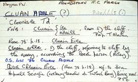
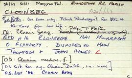
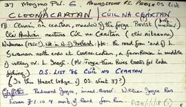
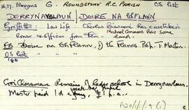
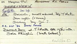
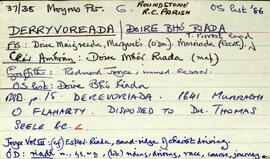
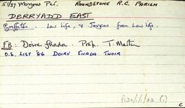
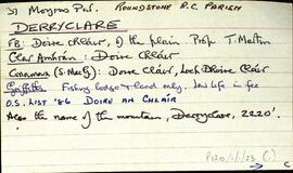
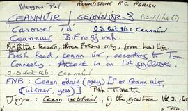
Set of index cards describing the physical features of Ceannúir [Canower]. Descriptions given are of Tulach Bhuí, Paiste, Cora na gCruicíní, Tráíní, Bealach an Ghiorria, Oileán na Táimhe, Cora an Oileáin, Cora na hAbhann, Tulach and Aill na Tulaí, Staca, Portach Bán, Caladh Pheadair Mhór, Garraí Mór, Aill Uí Ghábháin, Cora Shéamus Uí Chonaire, Cora Mhongáin, Gleann na gCoileach, Cora Leachta, Rua Oileán, Children's Burial Ground and Ceannúir Harbour. Sources of information credited are Tom Conneely, and Joe Joyce, a native of Ceannúir.
Untitled