UGA P/P120/1/3/26/1
·
Item
Part of Personal
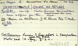
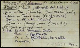
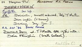
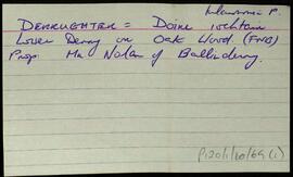
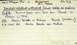
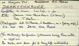
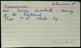
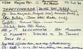
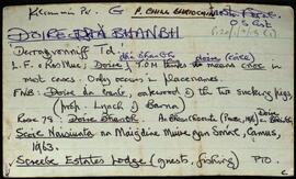
Index card giving a list of references for the townland of Derrynacleigh, [Doire na Cloiche], namely the Congested Districts Board, the OS Field Name Books, Griffith's Valuation, and some information on pronunciation derived by Tim Robinson from speaking with local people.
Robinson,Tim,Ireland. Congested Districts Board for Ireland