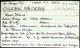
Set of index cards describing the local features of the townland of Oileán Máisean [Mason Island]. Included in the descriptions are Mulán na Srathrach/An tSrathair [Straddle Rock on the OS maps], Bealach na Srathrach, Trá an Éadain, Trá Bheirtreach, Carraigh Dháimhiú, Tóin an Oileáin, Guaire na gCrámha, Aill na Croise, Garbhcharraig (Rough Rock on the OS maps), Carraig an Ghun (Gun Rock), Oileán Aimhréidh (Avery Island), Garraí na Cilleach (marked as a burial ground on the OS maps), Lochán an tSeanduine, Carraig an tSnámha, Loch na dTaibhsí, An tAircín, Béal an Tairsí, and Oileán an Chortha. Some local individuals are credited with providing some of the information given for this townland, namely Joe Casey, an O Cathasaigh (noted as Joe Casey's son), and Brian Skinner.
Robinson,Tim,Casey,Joe,Cathasaigh,O.,Skinner,Brian