UGA P/P120/1/3/43/1
·
Item
Part of Personal
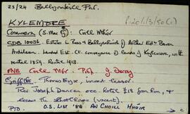
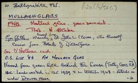
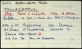
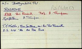
Set of index cards describing some of the local features of the townland of Letterbeg, [Leitir Beag]. Included are descriptions of Breillín (a small projection of the cliff face in Cuigéal), Duirling na nGabhar, Scailp Nóra Ní Allúráin, Loch an Mháma, Carraig Leathan, Cuainín na nGabhar, Béal Bhráidoileán, Fó na Sáibhéiracht, Fó Jack, Fó Caol, Cuigéal, Trá Mhór/Trá Bheag, and Bráidoileán. Local man Paddy Hearne, and an unidentified local woman are credited with providing some of the information.
Untitled