UGA P/P120/1/1/5/1
·
Item
Part of Personal
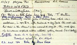
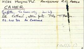
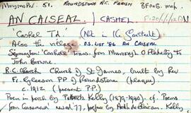
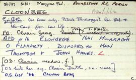
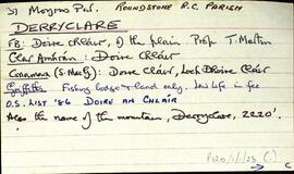
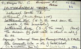
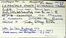
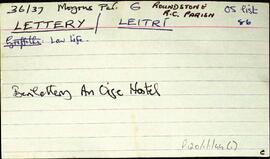
Set of index cards describing monuments and historical buildings in Ballinafad [Béal an Átha Fada]. Included in the descriptions are the Canal Stage, the islands in Ballinahinch Lake, the Roman Catholic Chapel St. Joseph's, Ballinafad national school, Loch na Brocaí, Cosán an Aifrinn [The Stirabout Road], Hynes' Park, St. Andrew's Bay, and Lisnabrucka. Mr. and Mrs. Willie O'Malley of Ballinafad are credited as being the sources of some of this information. Includes an anecdote about Countess Markievicz's visit to Ballinafad in 1907.
Untitled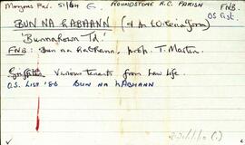
![Oiriúlach [Oirbhealach]](/uploads/r/university-of-galway-archives/c/e/b/ceb4a6940880d6f40f6755266a823e2af35788fe371ccb40b92d23eb70eb675c/147_142.jpg)