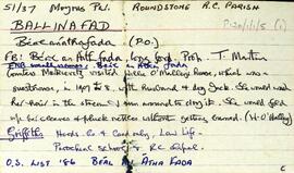
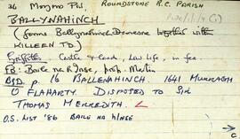
Overview list of the following features of the townland of Cill Éinne [Killeany], beginning with the letter R.Reservoirs, Roidín an Phúca, Roidín a' Mangaire, Roidín na hÁrd, Roidín an Lampa, An Round-tower, Roisín an Chírnín, Rinn Mhéith, Roidín Docherty (previously Roidín Donnolly after a teacher who lived there and collected bullán stones), the Rectory, Réalóg an Túir, Roidín an Bábhúin, An Ró Nua, An Réalóg, and Róidín Mháirtín.
UntitledIreland
32 Archival description results for Ireland
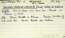
Set of index cards describing some of the physical features of Derryvealawauma [Doire Bhéal an Mháma]. Included in the descriptions are Cnoc Doire Bhéal an Mháma, Port an Dúín, Log Mhám Té, the Children's Burial Ground, Máméan, and Bun an Chnoic. A note on Bun na gCnoc and its status as a Gaeltacht during the Recess school boycott. Local Tamhnach Mór and Leitheanach people are credited with providing some of the information.
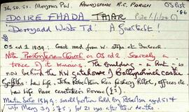
UntitledSet of index cards describing some of the local features of Doire Fhada Thiar [Derryadd West], a Gaeltacht area. Included in the descriptions are a note about the ruins of a Presbyterian Church, The Angler's Return (includes some notes on the Robertson family), Cor na mBriathare, Aill na gCúil, the fishery, the dyke, Botha Guaire, Sruthán Dearg, Céibhín Ghleann Aighneach, Lochán an Chaoile, Caorán an Iolra, Cloonisle Quay, Loch an Doirín, Aill an Eibhinn, Abhainn Mhór, The Fishery Hill, Caorán na Scraithe, and Imlach. Locals Pat and Annie Conneely, and Joe Nee credited with providing some of the information.
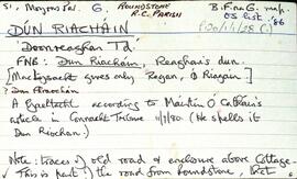
UntitledSet of index cards describing some of the local features of Dún Riacháin [Doonreaghan], a Gaeltacht area. The features described include Cora Hara, Doon House (originally the home of the Hazell family), Aill an Eibhinn, the Cashel Training Centre, Log an Iarainn, Caladh Mharcuis, and Fox Island. Tom Conneely was a local source who provided some of the information relating to this townland. Tom McDonagh of Tamhnach Bán told a story of a fox and a limpet in connection with the naming of Fox Island.
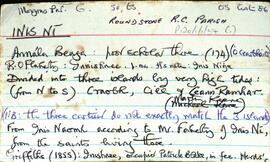
UntitledSet of index cards describing the physical features of Inis Ní [Inishnee]. Located in Moyrus Civil Paris, and the Roman Catholic Parish of Roundstone. Robinson explains that Inis Ní is divided into three islands by very high tides. From North to South, these are Craobh, Cill, and An Ceann Ramhar. Data from the 1820, 1841, and 1851 census returns are included, Congested Districts Board data, some history of ownership dating back to the 16th century, and some information from the 1st Report of the Fishery Commissioners in 1836. Physical features which are described are: Tobar Cholm Cille [on the OS map, St Brendan's Monument is marked in the same place], Árd na gCapall, Caladh na bPortán, Caladh Flathartaigh, An Sruthar, Cloch Mhór Róisín, Poll Pháidí, Caladh Keane, Tuairín, Cora Mhór, Scaith Dhubh, Caorán, Glasoileán, Gleann na gCoileach, Carraig an Bhranda, Oileán an Chlaí, Loch Bheag, Gleann na gCat, Cnocán Mhairgín, An Storraicín [An Stoiricín], Aille an Gharraí Rua, Aille na Caillí, Cara Beag(a), Doilín Freangach, Caladh Cam, Cuan Leice, Poll Tobac, St. Mathias's Chapel, Na Bruachaí [Mud Hole], Maoilín Dóite, Cáblachaí, Caladh na Loinge, St. Brendan's Well, Inis Ní Lighthouse, Gleann na gCapall, Troscaí, Cnocán Árd Dhaibhéis, Oileán an Choirce, Aill na nÉan, Dóilín Mhór, Bóthrín Gaskin, An Chloch Bhiorrach, Croabh [Creevecarton], An Ceann Ramhar, Cill, Aill Dingle, An Duirling Bhán, Crompán Mór, Oileán na gCapall, Caladh Bháid Mhóir, Gleann Dúlamáin, Cnocán an Tuairín, An Comhartha, Cnocán Tine Cnáimh, Giúróg, Mhaidin an tSagairt, Cora Mháire Ní Iarla, Doire Fhatharta, Donegal, Carraig an Fox (connected with the story of the fox and the limpet - see also Fox Island, near Cashel), Cnocán an Fhatharta, Coirnéal Sáraithe, Cooneen na Roan, Cuainín, the Inis Ní Bridge, The Wire, Fort Island, Inis Ní National School, Muing na Fola, Daoláin, Tobar an Rí, and The Danes Fort. Many local sources are credited with providing information and stories. Those credited are Pádraig Nee, Festy Nee, Rose Green, Michael King, Mr Faherty, Martin Keene, Michael Keane, Conor Hamill, Paddy Folan, and Nimmo's map of 1823.
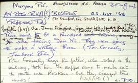
UntitledSet of index cards describing some of the features of An Ros Rua [Rosroe]. Robinson quotes local sources in summarising the history of the village in the 19th century, once quite a busy harbour, but declining as a village early into the Famine. Features described include the Rosroe Boat Harbour, a marsh North-West of Rosroe Lough called Muing Sanders, Cnocán Rí, Tamhnach Mór, The Lily Lake, Rosroe Bay, Bun a Trinse, Caladh Bháid Mhóir, Cora an Trá, The Poorhouse, Sruthair na Míoltóg, Cora an tSalainn, Loch Stiofáin Uí Mhongáin, Cora Phádraig, Cora Raithní, Loch Barr an Bhaile (where Marconi experimented with kites), and Locháin an Dubhaigh (The Mud Holes). Credited with providing information are Tom and Peter Conneely, Joe Joyce, Tom Conneely, and Joe Joyce.
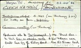
UntitledSet of index cards describing some of the local ecclesiastical, historical, and geographical features of Roundstone, [Cloch na Rón]. Background information sourced from Hardiman, and from the 1849 sale of the Martin Estate which covers the building of a pier there by the Fisheries Board and Alexander Nimmo. Included in the descriptions are the 19th century Protestant Church and its memorials, the Presbyterian Meeting House which was demolished in 1930, the Presbyterian Church, the Franciscan Monastery, The Fort, (occupied for a while by Sting of 'The Police'), The Old Store, Garryowen, Srutháin na Srúille, the Harbour, Ballagh House, Roundstone Bay, Waymount, Clougherty's (a shop and pub, and the site of the current Garda station), Bólard, the Coastguard's Office (referred to as The Boat House in 1899 map), Farrell's Road (a site of several Famine graves), Ballagh House, Newton Buildings (now the site of the local Health Centre), The Old Quay, the Catholic Church which was built in 1830, and the knitting factory. Summary of some of the information from the Royal Commision of Inquiry into the State of Irish Fisheries, 1836, from the Roundstone Famine Relief Committee, and from the Martin Estate Sale document of 1849. One card giving an account entitled 'The Story of Alice', referring to Alice McCaulter. Noel King, Michael Verron, M. Bairéad, and John McQuaid are all credited with providing some of the information and anecdotes in these notes. The Galway Vindicator was also a source of information about the Roundstone Famine Relief Committee.
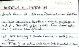
UntitledSet of index cards describing some of the history of Iorrus Aithneach [Iorras Aintheach], and how its local people have survived of the past few hundred years. A mill, and working the sea were its residents' two main occupations, with some seasonal work described here.
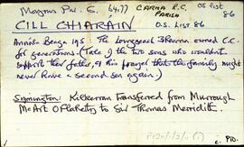
UntitledSet of index cards describing some of the features of the townland of Cill Chiaráin [Kilkieran]. One card summarising information from the Irish Wasteland Improvement Society. Features described include An Gleann Mór, Glenmore House (a history of its ownership), Teach Pobail Chill Chiaráin (which dates back to 1879), Comharchumann Chonamara Thiar, a note on the Irish Salmon Producers Group, Crocán na Sealaíocht, Cnocán na mBuachaillí, Tobar Muire, St. Kieran's Church (known locally as Leaba Chiaráin, Caladh na gClimíní, Droighneach, Cnoc Binn Bhuí, Cionlaí, Aill na Brón, Bánrach Árd, An Chathair, Coradh na gCuaig, Sliabe Doite, An Bhrocach, Crompán Bréan, Crompán an Mhaide, Cloch na gCailleach, Crompán an bhFiann, Carraig Mhór, Loch na Sióige, Aill na Méaracán, Cora na gCapall, Oileán an Charnáin, Log Riabhach, An Roisín, a card listing some of the businesses in the village of Cill Chiaráin, Crompán Beag, An Crompán Mór, Loch an Óir, and Abhainn an Mhuilinn. Some local people are named, credited with providing some of the information about the townland. These are Seán O'Ceoinín, Martin Smith, Eoin O'Néill, Máire Canavan, M. O'Conghaile.
UntitledSet of index cards describing some of the local features of the townland of Ardkyle, [Ardchoill]. Descriptions are given of Freaghillaun South (Freegh Island), Carraig Ghéar (Carrigeen South), Cuainin Garbh, Ross Beach, Poll na gColm (Ooeycolum on the OS maps), Glasoileán, Leac na mBó, Leac na Sronna, and Fruaigh Leathan. Some notes are included offering musings on the meanings of the different place names. Paddy Heanue of Letterbeg, and an old man who lives in the last cottage in Ardkyle are credited as providing some of the information therein. A note on a ruined megalith, 25 metres from a cliff ledge. A letter from Mike Gibbons (1988), is credited as being the source of some of the information.
Untitled