UGA P/P120/1/8/1
·
Item
Part of Personal
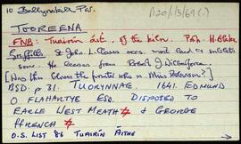
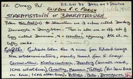
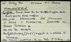
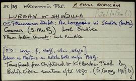
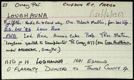
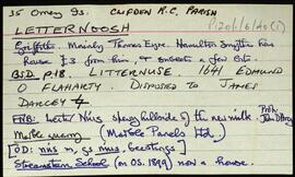
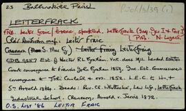
Series of index cards describing the townlands within the civil parish of Ross. Robinson indicates that the parish of Ross is now divided into the Roman Catholic Parish of Leenane (Kilbride), and the Parish of Clonbur (Ross). A note with an explanation from the 'History of Tuam', about the history of Kilbride Parish. An A4 sheet with an extract from a piece about an orphanage in Aasleagh. A handwritten note is on the back, addressed to Tim from Nora Keane.
Robinson,Tim