
558 results with digital objects
Show results with digital objects
UGA P/P120/1/13/3/1
·
Item
Part of Personal
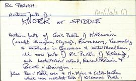
Overview list of the following townlands within the Western Parts of Knock [An Cnoc] or Spiddle [An Spidéal]. Robinson describes this as "Western parts of Civil Parish of Killannin (except Derrynea, Clynagh, Barraderry, Keeraunbeg and townlands in Faromna and Leitir Meallain, all now part of the RC Parish of Killeen and Leitir Moir island, Eanach Meain, and Beal a' Daingin... plus Ros a' Mhíl area of Na Mine and Cartron Leathan which were isolated bits of Kilcummin Parish). An Bhánrainn Bhán Theas [Banraghbawn South], Baile na rabhann theas [Ballynahown South], Caorán na gCearc Theas [Keeraunnagark South], An Chloch Mhór Theas [Cloghmore South], An Chloch Mhór Thuaidh [Cloghmore North], Doire Choill [Derrykyle], Indreabhán [Inveran], An Leathchartúr [Cartron], An Tulaigh [Tully], Na Mine [Minna], Tóin an Chnoic [Tonacruck], Ros a' Mhíl [Rossaveel], Na Doireadha [Na Doiriú Theas], and Baile an tSléibhe [Ballintleva].
Robinson,Tim
UGA P/P120/1/7/31/1
·
Item
Part of Personal
Set of index cards describing some of the local features of Úraid, [Oorid]. A note on the O'Malley family who were are prominent here. A local story of a crock of gold, also mentioned in Mac Giollarnáth's 'Annála Beaga' is relayed here. Brief descriptions are given of Loch an Roisín, Clochar, Loch ó Dheas, Tulaigh Liagáin (a note and illustration of a structure found to be a sheltering wall for sheet, the first such discovery by archaeologists in central Connemara south of the Galway to Clifden road). Tulach an Bhroic, Sruthán Uí Chonghaile, Loch na gCrámh, Tulach na Reilige, and Loch an Óráin are all given brief descriptions. Local man Billy Maguire, Jo O'Malley of Seana Chaola, and Peter Joyce of Úráid are all credited as being local sources of information. Mike Gibbons and Seán O Nualláin helped with the identification of the structure in Tulaigh Liagáin in autumn 1986.
Robinson,Tim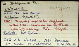
UGA P/P120/1/3/74/1
·
Item
Part of Personal
Set of index cards describing some of the local features of the townland of Ungwee, [Iong Gaoithe]. Several different spellings and versions of the names are included in the Field Name Books, including Iongaid, Ungbuide, Ongbuide yellow hill. Cards are devoted to features including pre-bog walls (no further information on this card), Lough Naguroge (Loch na n-guiróg). Mike Gibbons credited with providing some of the information.
Robinson,Tim,Gibbons,Mike
UGA P/P120/1/6/61/1
·
Item
Part of Personal
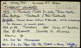
Set of index cards giving a brief description of Turbot Island, [Tairbeart]. A note on the last inhabitants of Turbot Island, around 50 or so people who left the island in winter 1978/79 after a particularly tough winter when 3 men drowned. A note on when the island first got electricity. Also included are descriptions of Caladh Mór, Carraig an Duibhéin, Maoileán an Mhadra, Maoileán na nÉan, Carraig Leathan, Fuach Black, Carraig a Graiflin, Cuainín, Bantrach Bhuí, Réileán, Cairín, Poll Trá, Dúilic, Tóin an Oileáin, Cois, Carraig na bPortán, Carraig Gheagáin, Lochtaí, Lochán na Móna, Leic, Carraig na Rón, and Úbhra Mhór and Úbhra Bheag. Festy Conneely (once an islander), John Price of Eyrephort, and the un-named residents of the nearest house are credited with providing some of the local information.
Robinson,Tim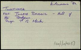
UGA P/P120/1/10/93/1
·
Item
Part of Personal
Index card relating to the townland of Tullyvrick, [Tulaigh an Bhroic].
Robinson,Tim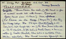
UGA P/P120/1/6/60/1
·
Item
Part of Personal
Set of index cards giving a brief description of Tullyvoheen, [Tulaigh Bhoithín]. Included is a note on Thomas Frewen who held most of the land in fee at the time of Griffith's Valuation. Lady Leslie (mother of Winston Churchill) once visited here. A note on the workhouse, and fever hospital, and the graveyard. Also included are a description of Cnoc Uí Choigligh, Clifden District Hospital, Loch na mBreac Caoch (home to some very large trout), and Caislín. T. Joyce of Shanakeever, and Rory Lavelle are credited as providing some of the local information.
Robinson,Tim,Conneely,Festy,Price,John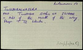
UGA P/P120/1/10/92/1
·
Item
Part of Personal
Index card relating to the townland of Tullyvealnaslea, [Tulaigh Bhéal na Slí].
Robinson,Tim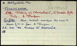
UGA P/P120/1/3/72/1
·
Item
Part of Personal
Set of index cards describing some of the local features of the townland of Tullyconor, [Tulaigh Uí Chonchúir]. Included are description of Derrynasliggaun Lodge (Doirín na Sliogán), a list of the memorials in the Protestant Church at Aasleigh, and Tullyconor Bridge. A Mrs. Willoughby is credited with providing some of the information for Derrynasliggaun Lodge.
Robinson,Tim