UGA P/P120/1/10/25
·
Item
Part of Personal
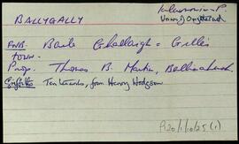
Two index cards relating to the townland of Ballygally, [Baile an Ghallaigh]. A note on Sliggagh, or Shelly Land.